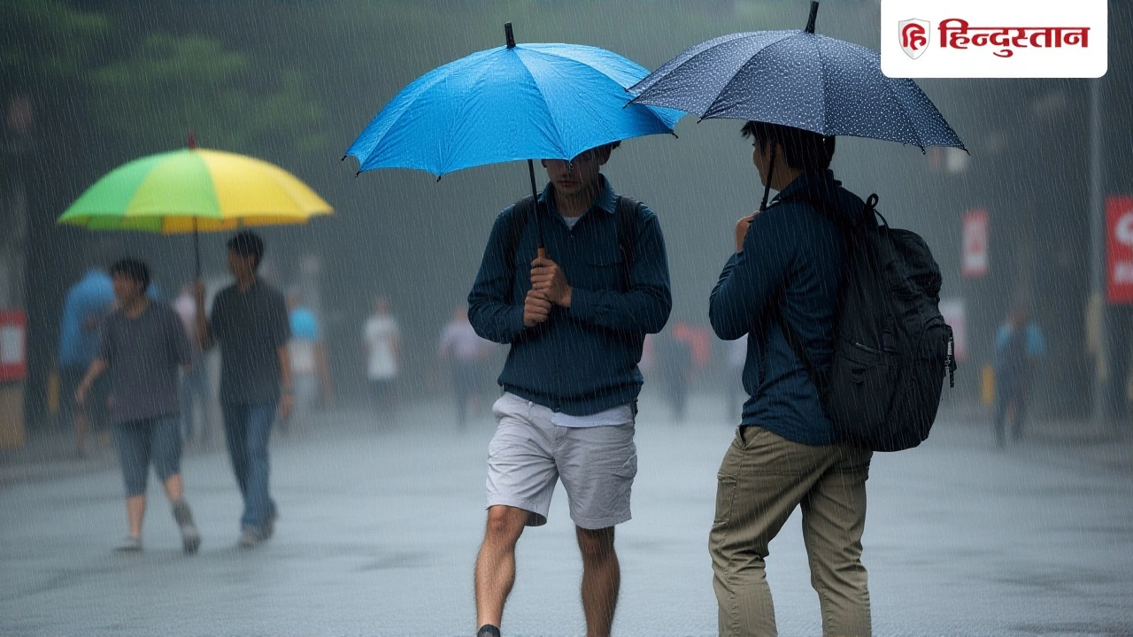
When the India Meteorological Department issued its alert on November 24, 2025, residents of coastal Tamil Nadu and Kerala didn’t need a weather app to know something was brewing — the sky had already turned an eerie gray, and the wind carried the unmistakable scent of wet earth. Between November 24 and 28, South India is expected to be hammered by heavy to extremely heavy rainfall, triggered by a low-pressure system forming over the Bay of Bengal and intensifying near the Andaman and Nicobar Islands. The storm isn’t just rain — it’s a cocktail of 35–55 km/h winds, flooding risks, and disrupted lives, all unfolding just as the post-monsoon season should be winding down.
Where the Rain Is Coming — and Who’s Being Hit Hardest
The India Meteorological Department traced the origin to a well-defined low-pressure zone over the Malacca Strait and southern Andaman Sea on November 23. By November 24, it had moved into the southeast Bay of Bengal, and meteorologists now warn it could deepen into a depression by November 25, potentially affecting the Comorin region and the southwest Bay of Bengal. The result? Torrential rain across a wide arc: Tamil Nadu, Kerala, Lakshadweep, coastal Andhra Pradesh, Yanam, and the Andaman and Nicobar Islands.
In Tamil Nadu, 11 districts — Kudalur, Ariyalur, Mayiladuthurai, Nagapattinam, Tiruvarur, Thanjavur, Pudukkottai, Sivaganga, Madurai, Virudhunagar, and Ramanathapuram — are under extreme alert. Local administrators didn’t wait for disaster to strike: schools were shut on November 24. "We’ve seen what happens when you delay," said a district officer in Madurai. "Last year, one school basement flooded. This time, we’re not gambling."
Kerala’s Yellow Alert: A State on Edge
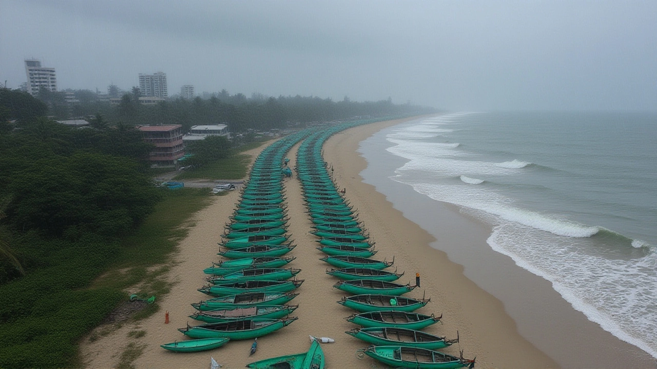
While Tamil Nadu went straight to action, Kerala issued a yellow alert for seven districts: Thiruvananthapuram, Kollam, Alappuzha, Kottayam, Pathanamthitta, Idukki, and Ernakulam. The India Meteorological Department predicts 7–11 cm of rain in 24 hours in spots — enough to overwhelm drainage systems already strained by earlier rains. Fishermen along the Kerala coast have been ordered not to venture out between November 22 and 24. "The sea isn’t just rough — it’s unpredictable," said K. Ramesh, a 52-year-old fisherman from Kochi. "Last time, we lost two boats. We’re staying ashore."

Wind, Water, and Warnings: The Full Picture
It’s not just the rain. Wind speeds of 35–55 km/h are expected along coastal areas, turning fallen trees and loose signage into deadly projectiles. In Andaman and Nicobar Islands, authorities have begun evacuating low-lying villages near the shoreline. The India Meteorological Department warns of possible landslides in hilly regions of Kerala and Tamil Nadu, especially near the Western Ghats.
Meanwhile, the northern half of the country is facing a completely different threat: a severe cold wave. Delhi’s minimum temperature is expected to plunge to 10°C on November 24 — its lowest in nearly two years. Fog is expected to reduce visibility to under 500 meters in parts of western Uttar Pradesh, disrupting rail and road traffic. In Bihar, Punjab, and Jammu & Kashmir, temperatures are dropping by 4–6°C below normal. "It’s like winter arrived two months early," said Dr. Priya Mehta, an environmental health specialist in Delhi. "People with respiratory issues are already flooding clinics."
Why This Storm Matters — Beyond the Rain
This isn’t just another monsoon tail-end. The pattern mirrors last year’s November cyclone that caused ₹1,200 crore in damages across Tamil Nadu and Kerala. But this time, the system is forming faster, and the moisture content is higher — a sign, some scientists say, that climate variability is making post-monsoon storms more intense. The India Meteorological Department has upgraded its forecasting models, but infrastructure hasn’t kept pace. Drainage systems in cities like Chennai and Kochi are still clogged with plastic and silt from last year’s rains.
For farmers, the timing is cruel. Just as they were preparing to sow winter crops like pulses and mustard, heavy rain could wash away seedlings. "We’ve already lost 30% of our mustard seeds to earlier showers," said farmer Rajesh Kumar in Tirunelveli. "If this continues, we’ll have to delay planting — and that means a smaller harvest by March."
What Comes Next?
The next 48 hours are critical. If the low-pressure system deepens into a depression by November 26, the India Meteorological Department may issue an orange or red alert for coastal Odisha and West Bengal. Emergency response teams from the National Disaster Response Force (NDRF) have been pre-positioned in Chennai, Coimbatore, and Thiruvananthapuram. Schools remain closed through November 25 in affected districts. Public transport in Kerala has been scaled back, and ferry services to Lakshadweep have been suspended until further notice.
For now, the advice is simple: stay indoors, avoid flooded roads, and keep emergency numbers handy. In a country where weather alerts are often ignored until it’s too late, this time, the warnings are loud — and the stakes are higher than ever.
Frequently Asked Questions
Which districts in Tamil Nadu have shut schools, and why?
Eleven districts in Tamil Nadu — Kudalur, Ariyalur, Mayiladuthurai, Nagapattinam, Tiruvarur, Thanjavur, Pudukkottai, Sivaganga, Madurai, Virudhunagar, and Ramanathapuram — have suspended school operations on November 24 due to forecasts of heavy to extremely heavy rainfall. Local administrators cited flood risks, potential landslides, and unsafe road conditions as primary reasons. The decision follows last year’s flooding that damaged over 120 schools in the region.
What does a yellow alert mean in Kerala?
A yellow alert in Kerala signals that heavy rainfall (7–11 cm in 24 hours) is likely in seven districts, raising the risk of urban flooding, waterlogging, and minor landslides. Residents are advised to stay alert, avoid low-lying areas, and prepare emergency kits. Unlike red alerts, yellow doesn’t mandate evacuations — but it does trigger district-level monitoring and emergency readiness checks by local authorities.
Are fishermen really being banned from going to sea?
Yes. The India Meteorological Department has issued a strict advisory prohibiting fishing vessels from venturing into the Bay of Bengal and Arabian Sea between November 22 and 24. Wind speeds of 35–55 km/h and wave heights of 3–4 meters make sea travel extremely hazardous. Over 8,000 boats in Kerala and Tamil Nadu have been ordered to dock, with state fisheries departments providing temporary shelter and food aid to affected families.
Why is Delhi experiencing cold weather while the south gets rain?
The heavy rainfall in southern India is driven by a low-pressure system over the Bay of Bengal, while northern India is under the influence of a strong western disturbance bringing cold, dry air from Central Asia. This contrast is typical in November — the south is still catching the tail end of monsoon moisture, while the north enters its winter phase. Delhi’s minimum temperature is expected to hit 10°C, with dense fog reducing visibility — a dangerous combo for commuters and health-sensitive populations.
How does this compare to previous November storms?
Last year’s November storm in Tamil Nadu and Kerala caused ₹1,200 crore in damages and displaced over 40,000 people. This year’s system is forming faster and carrying more moisture, suggesting climate change may be intensifying post-monsoon systems. Unlike 2023, when the storm hit abruptly, this one is being tracked for five days, giving authorities more time to respond — but also increasing public anxiety as the threat lingers.
What should people do if they’re caught in flooding?
If caught in flooding, move to higher ground immediately and avoid walking or driving through water — just 15 cm of fast-moving water can knock down an adult. Turn off electricity if safe to do so, and keep emergency contacts saved on your phone. In Tamil Nadu and Kerala, dial 1077 for disaster response, or contact local police. Avoid contact with floodwater — it may be contaminated with sewage or chemicals from damaged homes.